|
AWRA Alaska Northern-Region Meetings
April 16,
2015 Robert J. Henszey,
Transforming the Chena Slough through Fairbanks into a River 1900
to Present U.S. Fish and Wildlife Service Transforming
the Chena Slough through Fairbanks into a River Robert J Henszey, U.S. Fish and Wildlife Service Download
Recording (MP4) The Chena Slough was once a side channel of the Tanana River, carrying sediment-laden glacial meltwater through what we now know as North Pole and Fairbanks before returning to the Tanana River. Originating upstream near Eielson Air Force Base from a number of small contributing channels flowing from the Tanana River into a single channel now known as Piledriver Slough, the Chena Slough was large enough to attract turn-of-the-century steamboats laden with prospectors seeking gold, and to support the founding of Fairbanks. A series of historical maps and aerial photographs at select locations along the Slough show how increasing flow into the Slough was once considered to improve steamboat traffic, but ultimately the upstream connection to the Tanana River was severed by the Moose Creek Dike, and later by the Moose Creek Dam, to control flooding in Fairbanks. Once severed, the Chena Slough became a clear-water tributary to the Chena River at their confluence near North Pole, so what was once called a slough in Fairbanks is now known as the Chena River.
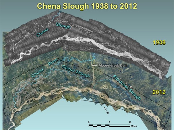
Chena Slough in 1938 (top) and in 2012 (bottom). The 1938 image fits within the black outline on the 2012 image.
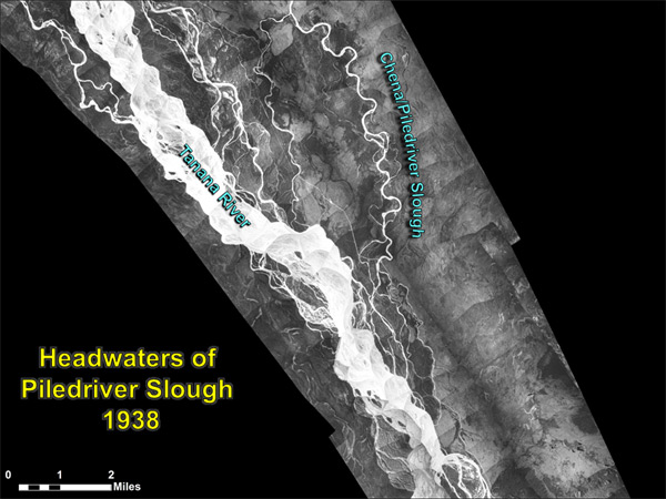
The headwaters of Chena Slough originated from a number of small contributing channels flowing from the Tanana River into a single channel now known as Piledriver Slough.
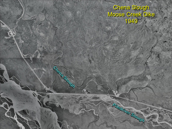
The Moose Creek Dike (now mostly gone) constructed between 1940 and 1945 near the present day Moose Creek Dam, severed the Chena Slough from its headwaters, and diverted what is now known as Piledriver Slough back to the Tanana River.
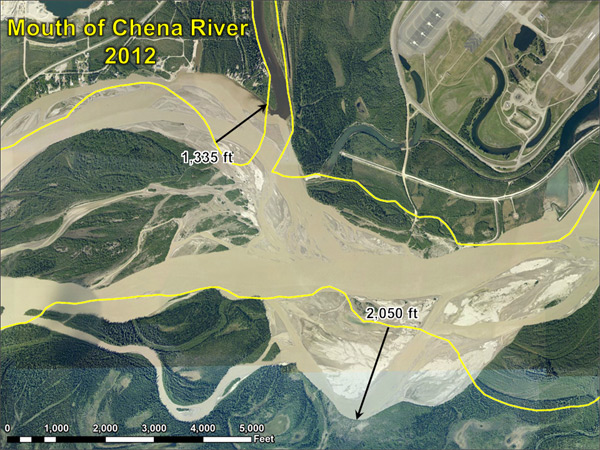
The mouth of the Chena River has changed substantially since it was known as the Chena Slough in 1938 (yellow outline).
|


